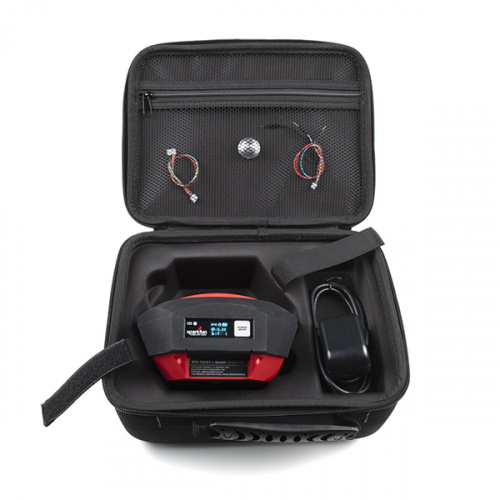
Hello and welcome, everyone! We are back, yet again, with even more new products for you to check out! This week, we are excited to announce our 20,000th SKU, the last (currently) planned enclosed RTK product to grace our shelves: The SparkFun RTK Facet L-Band! This is the mother of all our enclosed RTK products as it has an included NEO-D9S alongside the ZED-F9P and ESP32 WROOM, a larger internal antenna that can tap into L1/L2/L-Bands with ≥5dBi gain, and best of all, you won't need two units to access all of the Facet's functionality!
Following that huge act, we have an assembled version of the SparkFun MOSFET Power Control Kit, a breakout kit for for the RFP30N06LE N-Channel MOSFET. We wrap up the week with a few odds and ends like a U.FL removal tool and an EM-506N5 L1 GNSS Receiver. Now, let's jump into all of this week's new products!
Nathan is here to explain the differences between the Facets and what L-Band is!
Designed and manufactured in Boulder, Colorado, USA, the SparkFun RTK Facet L-Band is your one-stop shop for high-precision geolocation and surveying needs. For basic users, it’s incredibly easy to get up and running; for advanced users, the RTK Facet L-Band is a flexible and powerful tool. With just the press of a button, the RTK Facet L-Band is the fastest way to take centimeter-grade measurements. With built-in corrections, 14mm Real Time Kinematic fixes are less than a minute away. By connecting your phone to the RTK Facet L-Band over Bluetooth®, your phone or tablet can receive the NMEA output and work most GIS software. This is exactly how $10,000 surveying devices have been operating for the past decade - we just made it faster, more precise, and a lot more economical.
The RTK Facet L-Band utilizes corrections from u-blox's PointPerfect service broadcast from a geosynchronous Inmarsat satellite. The only setup required is a WiFi SSID and password. Once entered, the device will provision itself and periodically (once a month) update the decryption keys necessary to use the PointPerfect service. The price of the RTK Facet L-Band includes a 12-month subscription! However, additional years of service can be purchased.
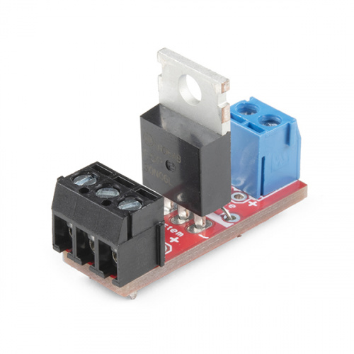
This is an assembled version of the SparkFun MOSFET Power Control Kit, a breakout PTH soldering kit for for the RFP30N06LE N-Channel MOSFET. This kit comes pre-assembled with everything already soldered onto the PCB. If you are looking for more control over projects that require a little more power than normal, but need a better way than your breadboard, this kit is perfect for you.
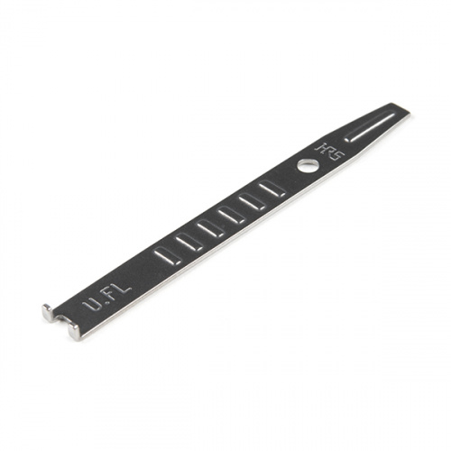
Specifically, this U.FL Removal Tool is for withdrawing U.FL-LP-040 and U.FL-LP-066 connectors from a seated position. The L-shaped bending portion of the jig is hooked on the connector cap to provide stable pressure & minimize the risk of damaging the U.FL SMD connector on your board. It may sound a bit silly to pick up a tool to remove a U.FL connector, but why risk damaging a $100+ board over U.FL?
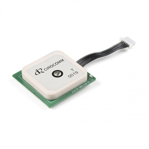
The EM-506N5 GPS receiver from USGlobalSat is based on the MediaTek high performance L1 band GNSS receiver. This is the new version from the EM-506, which includes on-board voltage regulation, an LED status indicator, battery-backed RAM, and a built-in patch antenna!
That's it for this week. As always, we can't wait to see what you make. Shoot us a tweet @sparkfun, or let us know on Instagram, Facebook or LinkedIn. Please be safe out there, be kind to one another, and we'll see you next week with even more new products!


Looking for informed opinions. Is it more or less likely L-Band correction technology will get cheaper for users or continue on the trend of expensive subscription based model? Contemporaneously, will Base/Rover/CORS setups remain popular or will they fall by the wayside? I am trying to decide which direction to invest: Facet L-Band or Base/Rover setups.
Again, I ask the question I asked when the RTK Facet first came out: "SW Maps" has been suggested for Andriod phones. Is there something similar for iOS (Apple) phones?
If I have to add in the cost of a new "smart" phone, it might just be cheaper for me to hire a "professional surveyor" -- since what I'm wanting to do is get an accurate comparison of the altitudes a couple of areas that are separated by ~100 meters horizontally, but do not have "line of sight" between them. (I need accuracy on the order of one inch on the comparison.)
Android phones/tablets at a pawn shop or ebay or facebook marketplace are cheap. 20$ is cheap.
Have you considered making a water level out of some garden hose? Even if you have to buy a couple of rolls of hose, and some clear tubing for the ends, it's going to be a LOT less expensive.
Feel free to send me whatever is left of the $1500 when you're done. ;)
I considered it several years ago when the problem presented itself. Won't possibly work -- for one thing vehicles running over the hoses would be VERY disruptive to its functioning...