×
SparkFun will be closed on Tuesday, December 24th, and Wednesday, December 25th, in observance of the Christmas holiday. Any orders qualifying for same day shipping placed after 2:00 p.m. (MST) on Monday, December 23rd, will be processed on Thursday, December 26th, when we return to regular business hours. Wishing you a safe and happy holiday from all of us at SparkFun!
Please note - we will not be available for Local Pick up orders from December 24th-December 27th. If you place an order for Local Pick-Up we will have those ready on Monday, December 30th.
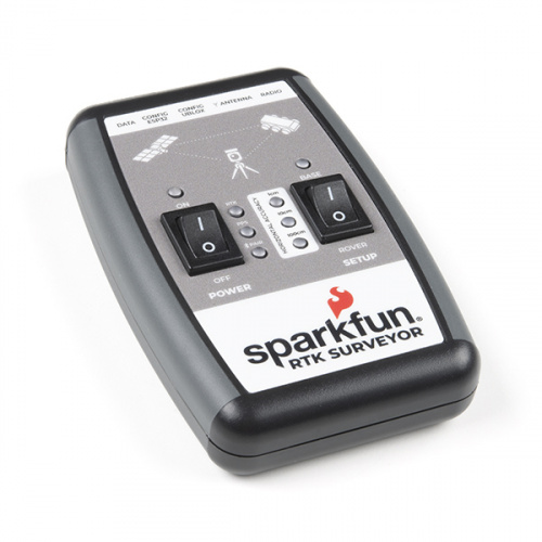
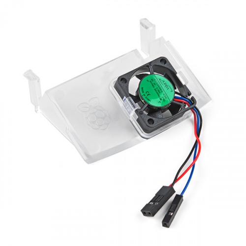
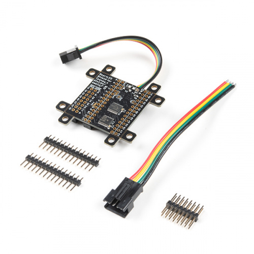
Hello everyone and welcome back to another Friday Product Post. If you celebrated Thanksgiving last week, we hope you were safe and ate a ton of turkey and maybe scored a few amazing sales during Black Friday and Cyber Monday. This week we have several new products to show off, and it all starts with the new SparkFun RTK Surveyor. This pre-programmed, ready-to-use GNSS/GPS product is now available for all of your surveying needs at a fraction of the price of other options on the market. Following that, we started carrying the new Raspberry Pi 4 Case Fan, the new Teensy 4 SmartLED Shield, and M9E-NANO RFID Module.
If you're curious when you'll need to get your order before the holidays, make sure to check out our Holiday Shipping 2020 page.
Now, let's take a closer look at all of our new products!
We're going to name ours "Tyler, The Surveyor"
The SparkFun RTK Surveyor is an easy to use GNSS receiver for centimeter-level positioning. Perfect for surveying, this preprogrammed device can also be used for autonomous driving, navigation, asset tracking and any other application where there is a clear view of the sky. The RTK Surveyor can also be used as a base station. With the flick of a switch, two RTK Surveyors can be used to create an RTK system capable of 14 mm horizontal positional accuracy. The built-in Bluetooth connection via an ESP32 WROOM enables the user to use the RTK Surveyor with their choice of GIS application on a phone or tablet. The built in battery allows field use for up to four hours, and is compatible with common USB battery banks.
The Raspberry Pi 4 Case Fan works with Raspberry Pi 4 and the Raspberry Pi 4 Case. Designed for overclockers and other power users, it keeps your Raspberry Pi 4 at a comfortable operating temperature even under heavy load.
The SmartLED Shield enables a Teensy 4 to drive high-quality graphics to HUB75 RGB LED panels, with 36-bit color and 240 Hz refresh rate across large panels (e.g. 128x64 pixels). A Teensy 4.0 or Teensy 4.1 with pins fits into the socket on the shield, and the shield can attach directly to the HUB75 panel or through a ribbon cable. The SmartMatrix library for Arduino makes it easy to draw basic graphics, create scrolling and static text, draw beautiful patterns using FastLED, and play animated GIFs on the panel.
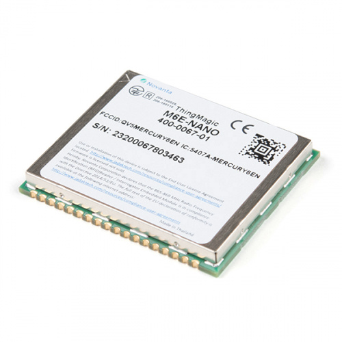
The M6E-Nano RFID Module delivers a small form factor embedded UHF RFID option with very low power consumption and is ideal for battery operated, low cost, small form-factor portable readers. The M6E-Nano’s wide RF output range (0 dBm to +27 dBm) is important for the read/write requirements for RFID-enabled printers and tag commissioning stations.
That's it for this week! As always, we can't wait to see what you make! Shoot us a tweet @sparkfun, or let us know on Instagram or Facebook. We’d love to see what projects you’ve made! Please be safe out there, be kind to one another, and have a great weekend!


An amusing thought crossed my mind (though it was likely too cold for it) -- a paint brush attached to the bottom of Rob's monopod while tracing out the flame...
Anyway, the one use I can see in my life for the Surveyor actually has vertical accuracy as more important than horizontal. And if I had two of them, the relative vertical between the two would be the primary thing. Although I'd like to see 2.5cm (1 inch), 5cm (2 inch) would be plenty, and 10cm (4 inch) would probably be OK. (Basically I'm needing to measure relative slope accross about 150m for water flow issues -- irrigation and flooding. The horizontal positions are what they are, but I need to know the relative verticals to a fairly accurate value, and it's too far to use a "hose level".) I've been toying with the idea of getting a professional surveyor out with his (or her) equipment, but that's gonna be a bit expen$ive.
Looking at the ZED-F9P's datasheet: It appears to offer the same vertical accuracy as it does horizontally, at least in RTK mode. (There isn't a line for vertical accuracy in non-RTK modes, so it's probably less than stellar without it.)